


😵After staying up all night preparing this travel guide for the Duku Highway, I'm sure it will be a must-read for those planning to visit Xinjiang!
It's like an endless dream, waiting for you to visit, and then return fully loaded. With your heart's desire, just step forward. Similar to Tibet, the most beautiful scenery is on the road. If life allows you one carefree journey where you can roam freely through the world, then set your sights on the Duku Highway.
Here are 20 FAQs I often receive from my customers.
1. How is Duku Highway divided into segments, how long are the kilometers, and are there any vehicle restrictions?
📌 Northern Section: Dushanzi - Qiorma - Nalati (230 kilometers, 5-7 hours, highest altitude 3500 meters)
Opening Period: Mid-June to early October, with occasional travel restrictions.
Vehicle Restrictions: Small passenger cars with up to 7 seats are allowed.
📌 Middle Section: Nalati - Bayanbulak (61 kilometers, 1.5 hours, highest altitude 3400 meters)
Travel Period: Mid-June to early October, with a lower probability of road closures.
Vehicle Restrictions: Currently, larger buses are permitted to pass through.
📌 Southern Section: Bayanbulak - Kuqa (270 kilometers, 5 hours, highest altitude 3300 meters)
Travel Period: Early June to mid-late October.
Vehicle Restrictions
🚙Direction of Bayanbulak to Kuqa: Small passenger cars with up to 7 seats are allowed.
🚍Direction of Kuqa to Bayanbulak: Vehicles with up to 19 seats are allowed.
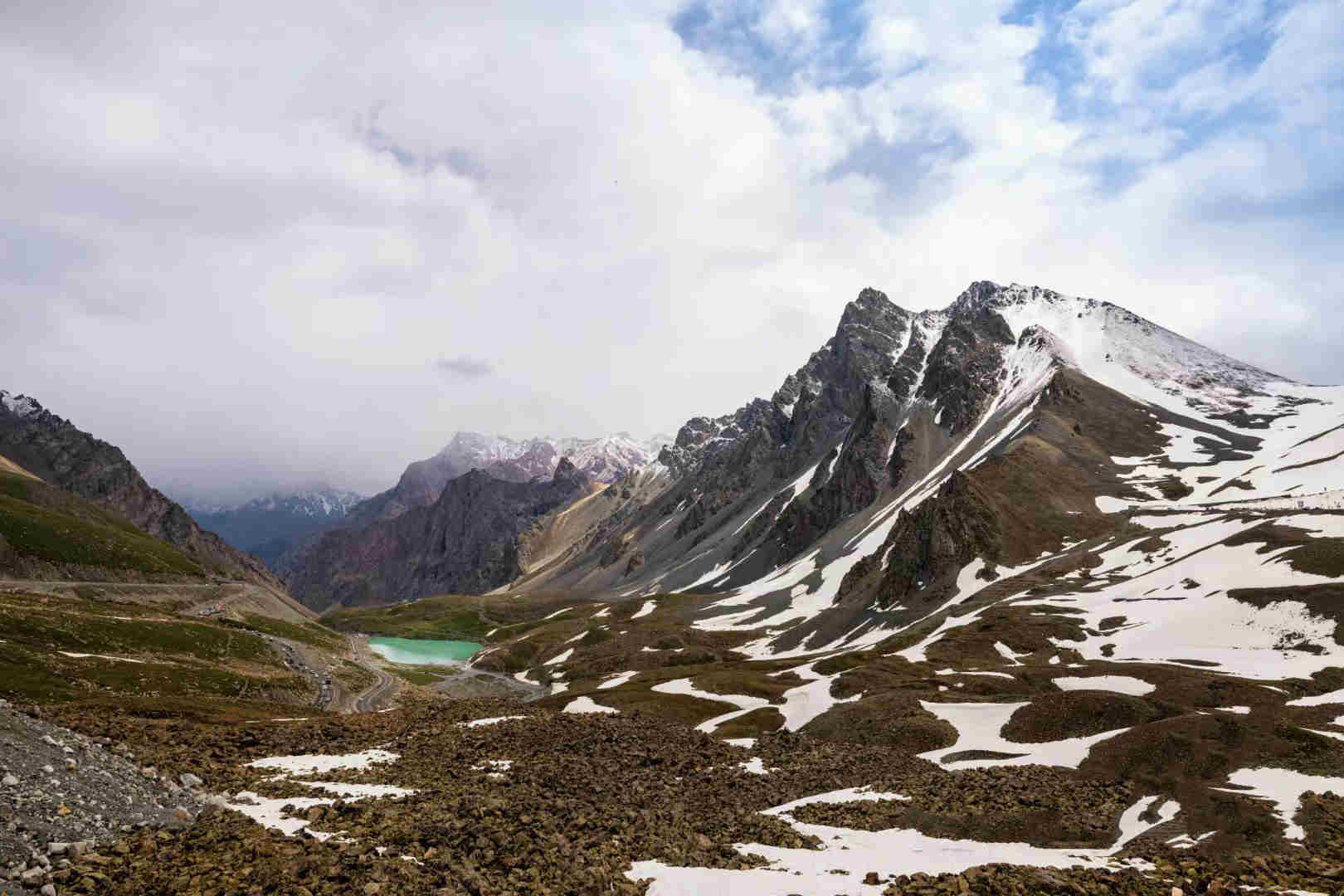
2. Where can you see snow along the Duku Highway?
You can see the snow at Haxilegen Pass, at an altitude of 3400 meters. Altitude sickness is almost non-existent here, so you can even experience a snowball fight in summer if you're from the coastal regions.
3. Can you really "experience all four seasons at a glance" on Duku Highway?
Absolutely! With a total length of 562 kilometers, half of which is above 2000m in altitude. The northern section is mountainous, the middle part features plains and lakes, and the southern end has grasslands and valleys. You'll experience all four seasons in one day, and the scenery changes dramatically along the way.
4. Does Duku Highway have Instagram-worthy spots? Is it worth visiting?
With its 562 kilometers of stunning landscapes, from grasslands to snow-capped mountains, and lakes to canyons, Duku Highway captures about 80% of Xinjiang's beauty. It's like a scene from a post-apocalyptic movie.
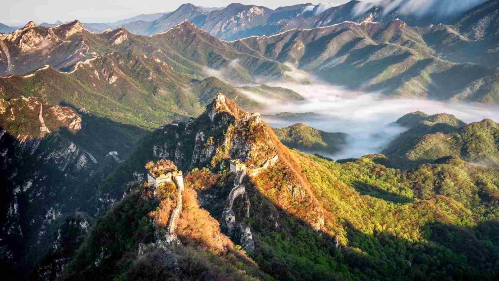
Besides China National Highway 318 from Sichuan to Tibet, Duku Road from Dushanzi Canyon to Kuqa Grand Canyon should be a must-visit in your lifetime!
5. Can you park, fly drones, or take photos along Duku Highway?
Yes, there are 33 parking spots along the route for rest, photography, and even drone flying.
6. Do you need warm clothing even in summer for travel on Duku Highway?
Yes! Even in summer, the weather on Duku Highway changes rapidly due to its geographical features. With temperatures varying greatly in a day, having 1-2 light-down jackets or windproof fleece jackets is advisable.
7. Is there a toll on Duku Highway?
There is a toll booth about 10 kilometers from Kuqa City, and the fee is 20 RMB. Isn't it worth enjoying such stunning scenery for just 20? : )
8. What are the entrance fees for attractions along the way?
🎟 Dushanzi Grand Canyon: 30 RMB/person
🎟 Tangbula Grassland: 30 RMB/person
🎟 Nalati Grassland Scenic Area: 95 RMB/person, shuttle bus 40 RMB/person
🎟 Bayanbulak Grassland: 65 RMB/person, shuttle bus 75 RMB/person
🎟 The Mysterious Grand Canyon of Tianshan Mountain: 41 RMB/person
🎟 Kuqa Royal Palace: 55 RMB/person
🎟 Luoburen Village: 40 RMB/person, shuttle bus 15 RMB/person
🎟 Kumtag Desert: 30 RMB/person, shuttle bus 30 RMB/person
🎟 Flaming Mountain: 40 RMB/person
🎟 Karez Well: 40 RMB/person
🎟 Grape Valley: 60 RMB/person, shuttle bus 25 RMB/person
9. Is there a speed limit on Duku Highway?
Yes, the speed limit is 40-60 kilometers per hour throughout the journey. After all, half of the beauty is on the road, and that's the charm of traveling in Xinjiang.
10. How to detour in case of traffic restrictions?
⭕ Traffic Control at the Entrance of Duku Highway: Head directly towards Sayram Lake to enter Yili Kazakh Autonomous Prefecture.
⭕ Qiorma Traffic Control: Travel via the Tangbula Gallery Corridor route to enter Yili.
⭕ Nalati Traffic Control: You can either go towards Nalati to enter Yili or Gongnaisi direction to Turpan or southern Xinjiang.
⭕ Kuqa Traffic Control in the opposite direction: Head directly towards Korla or go south towards Kashgar.
Remember to keep an eye on traffic information and detour if necessary.
11. Is there a risk of altitude sickness on Duku Highway? What is the highest altitude?
The highest altitude on Duku Highway is around 3400 meters, at Haxilegen La Pass. Altitude sickness is rare, especially if you pass through it quickly.
12. Is it convenient to find restrooms along the way?
🚰 Restrooms are available but not evenly distributed. There are more in the northern part and fewer in the central and southern sections.
13. Where are the gas stations along the way?
⛽ The 1st one is Dushanzi, the 2nd is Qiorma, the 3rd is Nalati Grassland, the 4th is Bayanbula Grassland, the 5th one is not far from Tianshan Mysterious Grand Canyon, in Ketaikelike Village, and the last one is in Kuqa City.
14. How many days does it take to complete the entire journey?
The Duku Highway route has about 12 scenic spots to visit, and there are many hidden gems along the way that will capture your heart. Planning for 3 days around should suffice. Remember, the journey is part of the adventure, so don't rush it.
15. What are the accommodation options along the Duku Highway? Where to stay?
😎 Dushanzi Kuitun: It's the starting point of Duku Highway, offering good accommodation and dining options.
🤣 Tangbula Grassland: There are limited hotels, but you can also choose to stay with local herders. Dining options are limited.
😘 Nalati Town: Plenty of hotels and guesthouses with various room options. Dining is convenient.
🙄 Bayanbulak Town: Numerous hotels and guesthouses with a wide range of room types, but make sure to book in advance.
😍 Kuqa City: The endpoint of Duku Highway, offering good accommodation options and a variety of dining choices.
16. Which attractions along the way are worth visiting?
🏔 Northern Duku Highway: Dushanzi Grand Canyon, Bayin Valley, Haxilegen La, Tangbula Gallery Corridor.
🏕 Middle Duku Highway: Nalati Grassland, Nine Curves & Eighteen Turns, Bayinbrook Grassland.
🏜 Southern Duku Highway: Tielimaiti Pass, Dragon Pond, Red Stone Forest, Tianshan Mysterious Grand Canyon.
From canyons to plains and then to Danxia landforms, the changing scenery is the road's charm.
17. Any Tips for Self-Driving on Duku Highway?
Check your vehicle's condition before the trip, including tires, and ensure you have a comprehensive self-driving itinerary. Prepare a paper map, and don't over-schedule your trip; enjoy the journey rather than rushing through it. Having a co-driver who can take turns behind the wheel can be helpful.
Also, consider bringing a power bank, and make hotel reservations in advance. During peak seasons, accommodation along the route can be in high demand. Pack some snacks for the road and practice safe driving; avoid road rage and conflicts with others.
18. Is there a limited time for traveling on Duku Highway?
Duku Highway is only open for half of a year. This year, it's officially opened on June 18th and accessible from 9:00 AM to 8:00 PM daily. Be mindful of the period open to traffic to avoid disruptions to your journey.
19. Who to contact for road condition inquiries on Duku Highway?
📞 Dushanzi Traffic Police: 0992-3353000
📞 Nalati Traffic Police: 0999-5034318
📞 Kuqa Traffic Police: 0996-5391888
📞 Hejing Traffic Police Brigade: 0996-5020778
In case of special circumstances, you can inquire by phone directly.
20. Any driving suggestions for a self-drive journey on Duku Highway?
🕛 Dushanzi - Ulan Sadek, 77 kilometers
🕒 Ulan Sadek - Qiorma, 55 kilometers
🕑 Qiorma - Nalati, 104 kilometers
🕧 Nalati - Bayanbulak, 61 kilometers
🕝 Bayanbulak - Dragon Pond - Kuruli, 156 kilometers
🕘 Kuruli - Kuqa Mysterious Grand Canyon - Kuche, 98 kilometers
🏡Since the northern segment has more mountainous terrain, consider arranging an overnight stay in the middle. There are many attractions near Nalati, making it a convenient option.
🎁 Recommended Travel Routes
- 10-Day Northern Xinjiang Circuit (Exploring the Northern Duku Highway Scenery)
Urumqi - Heavenly Lake - Koktokay UNESCO Geopark - Five-Colored Beach - Jiadengyu Valley - Kanas Lake - Hemu - Devil City - Sayram Lake - Nalati Grassland - Bayanbulak Swan Lake - Tangbula Grassland - Urumqi
- 9-Day Southern Xinjiang Circuit (Exploring the Southern Duku Highway Scenery)
Urumqi - Luobu People's Village - Korla - Tianshan Mysterious Grand Canyon - Kuqa Old Town - Kizil Thousand-Buddha Caves - Wensu Grand Canyon - Aksu - Hotan - Kaxgar Old City - Panlong Ancient Road - Kashgar
- 8-Day Time-Efficient Trip (Exploring the Whole Duku Highway Scenery)
Urumqi - Northern Duku Highway - Nalati - Southern Duku Highway - Tianshan Mysterious Grand Canyon - Kuqa - Kizil Thousand-Buddha Caves - Wensu Grand Canyon - Aksu - Hotan - White Sand Lake - Pamir Plateau - Tashkurgan - Wacha Highway - Karakul Lake - Kashgar
⛳ Travel Tips
✅ Xinjiang's attractions are often far apart, and long driving times can affect your travel experience and mood. To make your journey on the Duku Highway more relaxed and worry-free, we offer special small-group tours. SUVs or MPVs accompany you, allowing for spontaneous stops and a free-style travel experience, giving you peace of mind.
✅ Traverse both the northern and southern segments of the Duku Highway to explore the essence of both Northern and Southern Xinjiang's attractions. We can customize an exclusive itinerary according to your needs, with pure sightseeing and no shopping.
✅ Our local drivers are well-trained and familiar with the roads, ensuring your safety throughout your journey.
✅ We select comfortable local hotels for your stay, ensuring a good night's rest for a more relaxed trip.
✅ If you prefer self-driving, be sure to download offline maps in advance, familiarize yourself with the approximate locations of gas stations, drive carefully on gravel roads, and exercise caution.
✅ Xinjiang's climate has significant temperature variations between day and night, and the weather can change rapidly. Be prepared with short sleeves, shorts, a windbreaker, and a down jacket. If you have any other questions about traveling in Xinjiang, feel free to leave a comment or email us 📧directly.

